Track landslides
as they happen.
Alnuc uses SAR satellite data to detect surface change between passes — giving disaster management agencies, geological surveys, and infrastructure operators a continuous, weather-independent record of landslide activity.
Live alerts
Sector 4B
High confidence
Sector 2C
Medium confidence
Sector 7A
Low confidence
Last pass
The gap
Optical satellites go dark when landslides are most likely.
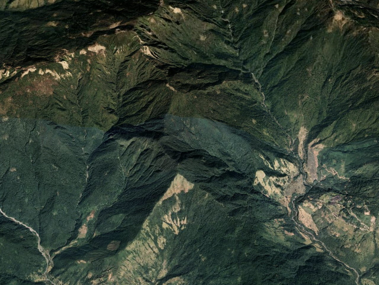
Geological surveys and disaster management agencies monitoring active mountain terrain need a consistent record of slope failures. Cloud cover, monsoon rain, and snow make optical imagery unreliable for months at a stretch, leaving critical gaps in the detection record exactly when conditions are most dangerous.
Gaps in the detection record
Optical imagery fails for weeks or months during monsoon and winter seasons — the periods of highest landslide activity.
No consistent baseline
Without regular passes, agencies can't track which slopes are failing or identify areas of repeated activity.
Complex terrain limits optical sensors
Cloud cover and shadow in high-altitude topography make optical change detection unreliable.

Coverage comparison
Optical
Blocked by weather
~28% uptime in monsoon season
Alnuc SAR
All-weather
100% uptime, every pass
How it works
Satellite pass to alert — automatically.
The pipeline runs continuously. Every new acquisition feeds directly into the processing chain with no manual steps.
Satellite passes
Sentinel-1 revisits same location using C-band radar to capture consistent, all-weather, day-and-night surface observations even through clouds.
Alnuc compares passes
The new acquisition is compared against the previous one. Areas where backscatter has changed significantly are flagged as candidate landslides.
Detections scored
A confidence score filters out low-quality detections on the basis of importance and probability
Agencies get the picture
Disaster and geological agencies receive georeferenced detections with every pass, with confidence scores and location
A detection every pass.
Because SAR works through cloud, rain, and snow, Alnuc produces landslide detections on every Sentinel-1 pass — no seasonal gaps, no missing monsoon months. Agencies get the same quality of data in January as in July.
Research
The science behind landslide detection.
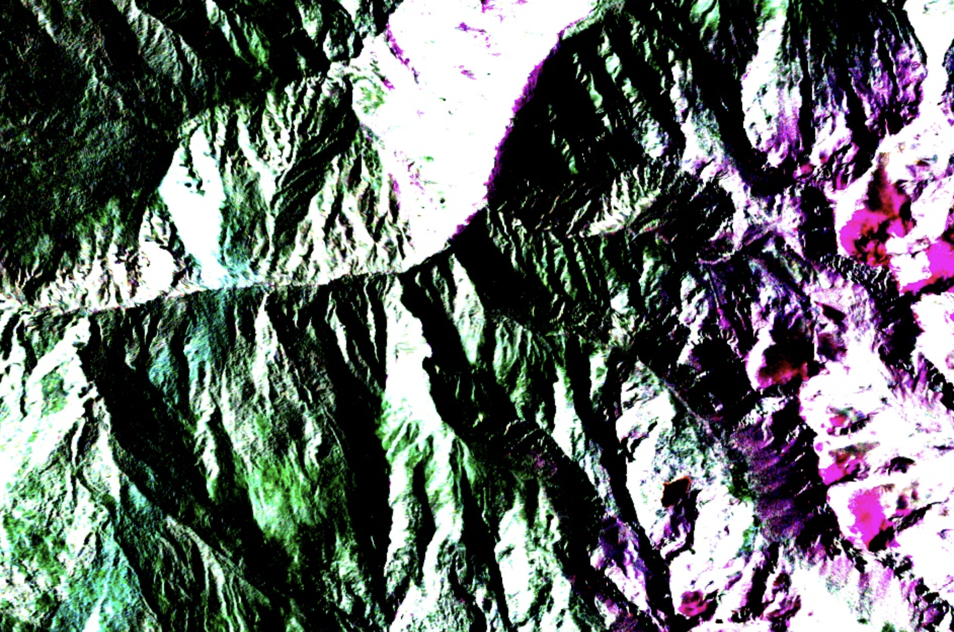
Alnuc detects landslides by comparing successive Sentinel-1 satellite passes and identifying areas where backscatter has significantly decreased on steep terrain — a reliable indicator of surface disturbance consistent with slope failure.
This approach is particularly valuable for disaster management agencies, geological surveys, and infrastructure operators in monsoon-affected mountain regions, where cloud cover creates months-long gaps in optical satellite coverage exactly when slopes are most active and landslide risk is highest. Alnuc fills that gap, providing a consistent detection record regardless of weather conditions.
Methodology
SAR Backscatter Change Detection
Satellite data
Sentinel-1 (ESA)
Application
Landslide Detection and Monitoring

Ready to detect landslides?
We work with disaster management agencies, geological surveys, and infrastructure operators to monitor mountain terrain. Let's talk about your monitoring needs.