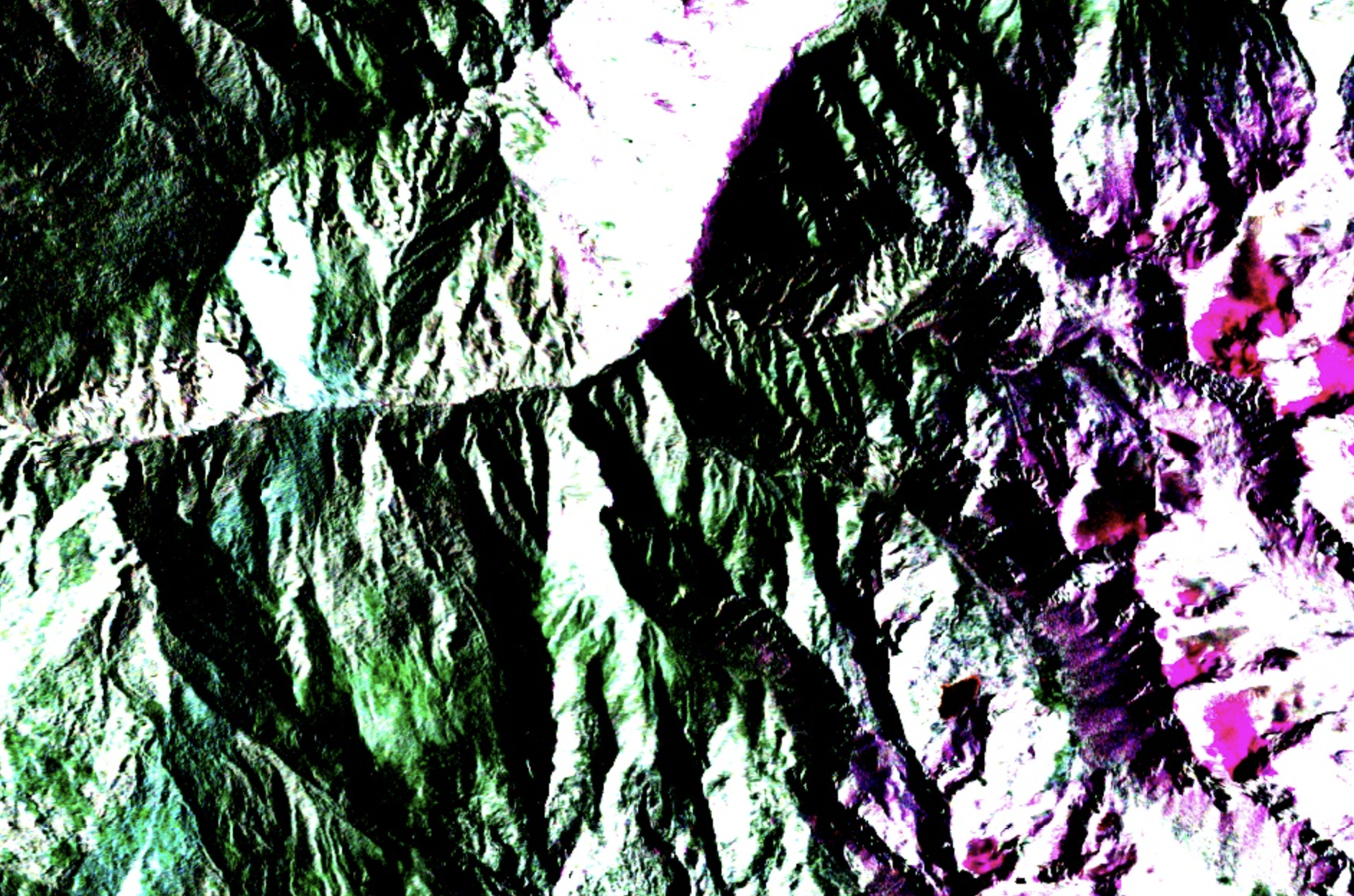
Every SAR pass captures two things: how bright the return signal is, and how it changes. Amplitude change between passes over the same steep ground is where you find evidence of surface disturbance. No other weather-independent sensor type gets you there at this cadence.
When a SAR satellite transmits a microwave pulse toward the ground, two things come back: amplitude and phase. Amplitude is the brightness of the return, essentially how strongly the surface reflected the signal. Phase is the position of the wave at the moment it returned to the antenna.
Most people working with SAR imagery only look at amplitude. It produces images that look vaguely like photographs, with bright returns from buildings and rocky surfaces and dark returns from water and smooth ground. You can interpret them visually. They're useful for mapping land cover, detecting floods, and tracking construction activity.
But phase is where the real information lives, specifically what happens to phase when you compare two passes over the same area.
If the ground hasn't moved between two acquisitions, the phase of the return signal will be nearly identical. If the ground has shifted, even by a few millimetres, the phase will be different. The difference is proportional to the displacement. This technique is called Interferometric SAR, or InSAR, and it's the basis of how Alnuc measures terrain movement.
The maths works because the wavelength of Sentinel-1's C-band signal is about 5.6 centimetres. A displacement of half a wavelength, around 2.8cm, produces a full cycle of phase change. Displacements smaller than that produce fractional phase shifts that are still measurable. In practice, well-processed InSAR data can detect ground movement at the sub-centimetre level.
There's a catch. Phase comparison only works when the surface is coherent between passes, meaning the scatterers on the ground haven't changed significantly. Vegetation is a problem: leaves move in the wind, crops grow, and the phase becomes decorrelated. Dense forest is essentially unusable for InSAR. Rocky terrain, bare soil, and built infrastructure hold coherence well.
In mountain environments, this is actually an advantage. The slopes most at risk, steep, rocky, and sparsely vegetated, are exactly the ones where InSAR coherence is highest. The technique works best where you need it most.
Coherence itself is also a signal. A sudden drop in coherence between two passes over a previously stable area can indicate surface disturbance such as a landslide, a debris flow, or a collapse. You don't always need to measure the displacement precisely. Sometimes the loss of coherence is the alert.
This is what makes SAR fundamentally different from optical remote sensing for terrain monitoring. Optical tells you what the surface looks like. SAR, when you use the phase, tells you how it's moving.