During a full monsoon season in a high-risk South Asian mountain corridor, optical satellite coverage dropped to near zero. A Sentinel-1 time-series analysis across 23 slope sectors reveals what that gap means in practice, and what becomes visible when you fill it with radar.
Consider a 60km mountain corridor with steep valley walls, active river channels, and road sections that have experienced partial failures in previous years. To understand how slopes in that corridor behave during monsoon season, you need data from June through September. That's the period of highest rainfall, highest soil saturation, and highest displacement risk.
The problem is that optical satellites can't reliably cover that window. In a typical monsoon season, usable optical scenes from Sentinel-2 or Landsat over such a corridor might number three or four, all clustered around brief clear periods in early June. After mid-June, optical data is effectively gone until October.
Sentinel-1 SAR doesn't have that problem. Over a four-month monsoon window, a standard Sentinel-1 acquisition schedule produces around 18 passes over the same area. Every one of those passes yields usable data regardless of cloud cover.
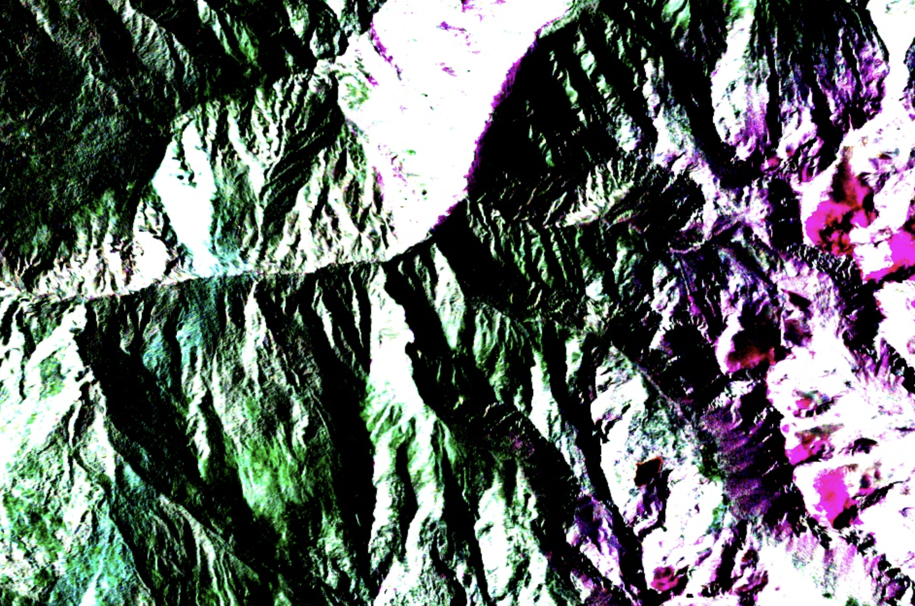
When those 18 acquisitions are processed through an InSAR time-series workflow, the picture that emerges is detailed. Each acquisition is co-registered to a reference scene, interferograms are generated for consecutive pairs, and phase unwrapping converts phase differences to displacement values in the line-of-sight direction. Atmospheric correction removes tropospheric delay artefacts, which are a significant source of error in high-altitude terrain.
Across a set of 23 slope sectors, results typically vary considerably. Some sectors show displacement below 5mm over the full four-month period, within the noise floor for this processing approach. Others show moderate displacement between 5mm and 20mm, consistent with seasonal soil moisture changes and minor creep. A smaller number show displacement above 20mm.
The most significant finding in this kind of analysis is often a sector that had been classified as stable based on the most recent dry-season optical assessment. The SAR time-series can show it moving steadily from early July onward, at roughly 3mm per week, with a slight acceleration in late September following heavy rainfall. That movement is invisible to optical systems during the monsoon. It only becomes visible in October when skies clear, by which point the cumulative displacement is larger and the window for low-cost intervention has narrowed.
This is the practical case for SAR-based monitoring in monsoon-affected terrain. It's not that SAR is more accurate than optical in some abstract sense. It's that optical simply wasn't there. The four months when slopes were most active produced three usable optical scenes. SAR produced eighteen. The difference in what you can see, and when, is not subtle.