Blog
Terrain, radar, and the data in between.
Writing from the Alnuc team on SAR monitoring, field work, and how disaster management agencies use deformation data.

Clouds don't stop radar. Here's why that matters for mountain monitoring.
Optical satellites need sunlight and a clear sky. SAR sends its own signal down and reads what bounces back, so cloud cover, monsoon rain, and snow are irrelevant. For agencies trying to track slope movement through a four-month monsoon season, that's not a minor detail.
Read post→
The part of radar data most people ignore, and why it tells you everything
Every SAR pass captures two things: how bright the return signal is, and how it changes. Amplitude change between passes over the same steep ground is where you find evidence of surface disturbance. No other weather-independent sensor type gets you there at this cadence.
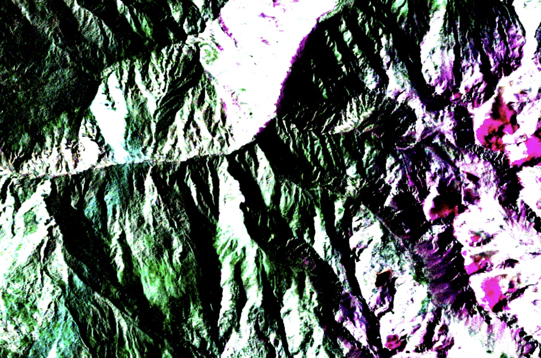
Four months of monsoon, zero optical data. What SAR shows instead.
During a full monsoon season in a high-risk South Asian mountain corridor, optical satellite coverage dropped to near zero. A Sentinel-1 time-series analysis across 23 slope sectors reveals what that gap means in practice, and what becomes visible when you fill it with radar.

How deformation data fits into mountain hazard management
SAR displacement maps don't make decisions on their own. Understanding how terrain deformation data can fit into hazard management workflows, what decisions it can inform, and where its limits are, is as important as the data itself.